The changing face of the Old Kent Road: What does the future hold?
Known as the cheapest spot on a Monopoly board, the Old Kent Road is set for major regeneration, but will it even happen, and who will it be for?
Old Kent Road is one of London's oldest thoroughfares.
For more than 2,000 years, it has served as South London’s main route into the capital.
Stretching south-east from Walworth to New Cross, the road cuts between Bermondsey and Peckham.
Established as a route into Londinium by the Romans, it later got its name as the road to Kent used by the medieval pilgrims going to and from Canterbury.
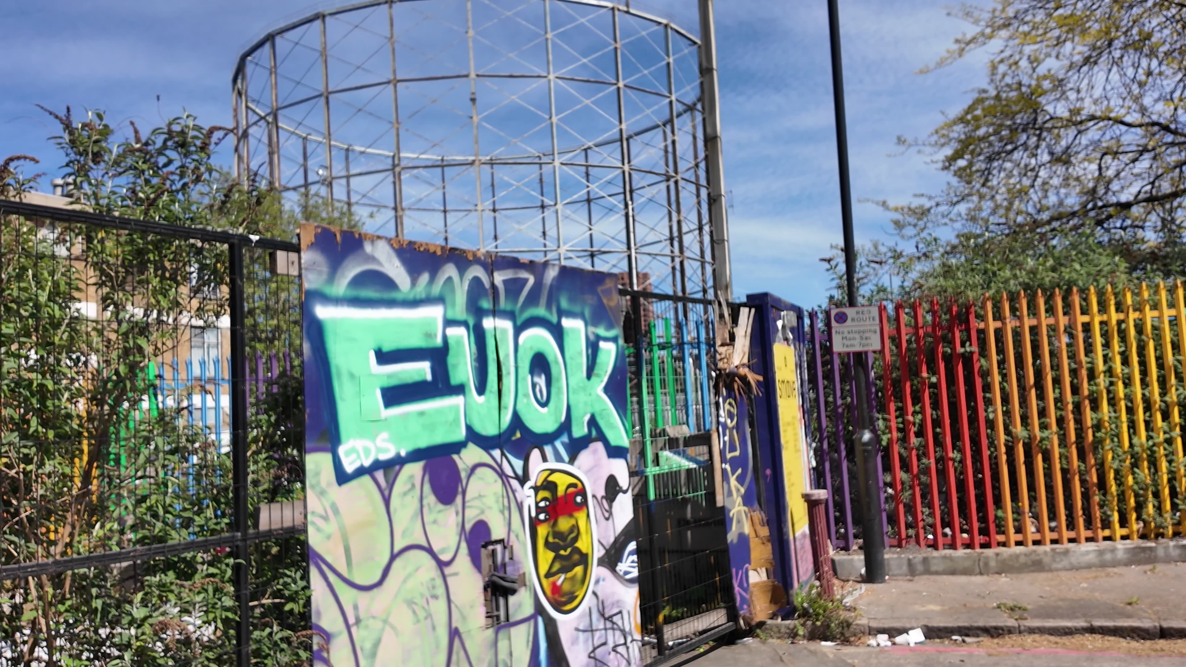
Once part of Southwark's industrial landscape, post-war Old Kent Road has fallen into disrepair.
While surrounding neighbourhoods – including Elephant and Castle and Canada Water – have undergone major regeneration, Old Kent Road has remained largely untouched.
However, since 2018 Southwark Council has been on a mission to change the down at heel image of its most famous road, granting planning permission for numerous developments on what were once industrial plots.
22,000 households currently languish on Southwark Council's housing waiting list and many argue that the new developments will not be affordable to local people.

Source: Old Kent Road Planning documents
Source: Old Kent Road Planning documents


Source: Old Kent Road Planning documents
Source: Old Kent Road Planning documents

Source: Old Kent Road Planning documents
Source: Old Kent Road Planning documents
Video by Evie Flynn
On Saturday 25 April 2026, hundreds of local residents and campaign groups marched from the Michael Faraday Memorial in Elephant and Castle down the length of the Old Kent Road, against what they describe as the 'overgentrification' of the area.
All photos and videos by Evie Flynn
All photos and videos by Evie Flynn
The Action Plan
A £10 billion vision
The Action Plan:
20,000
NEW HOMES
£10 bn
IN COST
10,000
JOBS CREATED
Ten years ago, the Mayor of London earmarked it as as an area ripe for change, with mass house building on a scale not seen south of the river since the Docklands redevelopment.
The Action Plan sets out ambitious targets to create 20,000 new homes, double the amount of jobs, develop green spaces and introduce anew ‘town centre’ – while promising to keep the community at its centre.
The regeneration is largely dependent on the Bakerloo Line extension, which will completely redraw the map between Bermondsey and Peckham. It would, if plans go ahead, introduce new stations at Burgess Park, Old Kent Road and New Cross – effectively spanning the length of the road.
Source: Old Kent Road Planning documents
Source: Old Kent Road Planning documents
"Its industrial character and its status as a major arterial road mean it’s often thought of as simply a means of getting somewhere ...rather than a destination in its own right.
"The regeneration will turn this on its head, making Old Kent Road a major central London destination, somewhere that people will come to live, work and enjoy their leisure time.
"The key to this will be the creation of a proper town centre for Old Kent Road."
Old Kent Road planning Website
Southwark Council
The beginning:
To understand the scope and length of the Old Kent Road Action plan, we need to go back ten years.
Origins of the London Plan:
The London Plan is the long-term development strategy for London, led by the Greater London Authority (GLA) and the Mayor of London.
It guides how London develops over roughly 20 – 25 years, covering housing, transport, economic growth, climate policy, infrastructure, and land use.
The first London Plan (2004):
The first official London Plan was published in 2004 under Ken Livingstone – the first directly elected mayor.
However, the only area earmarked for development in South London was Elephant and Castle.
The Old Kent Road area was mentioned as an important corridor but not an "Opportunity Area" in its own right.
"London thus faces a radical challenge, which requires a radical policy response." - Ken Livingstone (2004).
The second London Plan (2008):
Mayor Boris Johnson pushed for large-scale housing development across London as the city's housing crisis begins to escalate.
In response, he published alterations to Livingstone's existing plans in 2008 and again in 2011, abolishing the 50% housing target and encouraging boroughs to approve individual developments.
"So this Plan is more focussed than its predecessor. It concentrates on things of really strategic, Londonwide importance and does not try to micro-manage aspects better sorted out locally"
– Boris Johnson (2011)
The turning point for the Old Kent Road:
The 2014 – 2015 focus on the Bakerloo Line extension pushed the Old Kent Road to the forefront of major transport upgrades through South London.
The first Bakerloo Line extension proposal (2015). Source: TfL planning documents
The first Bakerloo Line extension proposal (2015). Source: TfL planning documents
Transport for London started treating the area as a “future Tube corridor”.
Planners realised you cannot build high-density housing in Old Kent Road without massive transport upgrades.
The road became the focus of a formal planning framework.
A major milestone:
Under Sadiq Khan's new London Plan, the Old Kent Road was officially labelled as an "Opportunity Area".
Southwark Council's first planning framework (2016). Source: Old Kent Road Planning documents
Southwark Council's first planning framework (2016). Source: Old Kent Road Planning documents
The road entered the core strategic London Plan framework.
This included:
Detailed planning commences:
Southwark Council held a public consultation from June – September 2017.
Feedback from residents included:
- More green space
- Manage air pollution
- Ensure more industrial land is kept for employment only rather than development
"Land zoning":
Southwark Council and the Greater London Authority (GLA) took the public's feedback into consideration and agreed on Old Kent Road's different 'zones'.
They defined areas as residential, commercial, or industrial and made sharper decisions about what industrial land stays versus gets redeveloped.
Southwark Council's proposed changes to the map, with a goal of retaining industrial space (2018). Source: Old Kent Road Planning documents
Southwark Council's proposed changes to the map, with a goal of retaining industrial space (2018). Source: Old Kent Road Planning documents
Other developments to the Action Plan included details on how tall tower blocks would be and where they would go.
Public consultations:
Further consultations revealed that residents wanted:
Video by Evie Flynn
Video by Evie Flynn
The final draft:
After years of consultation, in 2020 the GLA and Southwark Council had produced a near-final version of the Area Action Plan.
A plan set to become law:
Southwark Council produced the Draft Old Kent Road Area Action Plan (2024), which is the most complete version before it becomes law.
The final public consultation was held in April 2025.
Where are we now:
A Planning Inspectorate hearing will take place over two weeks, starting on 9 June and ending on 17 June, 2026.
Photo by Evie Flynn
Photo by Evie Flynn
Photo by Evie Flynn
Photo by Evie Flynn
Photo by Evie Flynn
Photo by Evie Flynn
Photo by Evie Flynn
Photo by Evie Flynn
However, campaigners from Save Old Kent Road and Southwark Housing and Planning Emergency (SHAPE) argue that the sweeping regeneration neglects the very communities who live and work near the Old Kent Road.
Of the 20,000 homes, 7,000 will be affordable and 5,000 will be social rent – making up 35% of the whole development.
However, questions have been raised ahead of the June review about whether the council will stick to this figure.
Campaign groups make it clear that they are not against development, rather they are calling for a model that takes existing residents into account.
Who currently lives on the Old Kent Road?
RESIDENTS
35,000
total residents
HOMES
14,500
homes
ETHNICITY
60.6%
of the population are from Black and Minority Ethnic communities
CHILDREN
25.3%
of the population are under 18
What do protesters say?
Michael Clinkett is a local resident and former business owner from nearby Rotherhithe.
He was evicted from his business premises of 22 years by bailiffs after his landlord repossessed the property on 16 January 2024 at around 4.30am.
Known as PLUSH SE16, it housed five Black-owned businesses that served the community – a Caribbean takeaway, car wash, barber, hairdresser, and music studio.
Interview with Michael Clinkett, local resident. Video by Evie Flynn.
"I think Southwark is already becoming unrecognisable. This is a serious issue."
Clinkett says the experience of physical displacement prompted him to launch the wider campaign #NoPriceOnCulture, which highlights the importance of protecting cultural infrastructure, independent businesses, and community spaces from redevelopment.
The movement argues that the social and cultural value created by local spaces cannot be measured purely in financial terms.
He says the council should prioritise providing “homes for our people” – lower-income families either on the social housing waiting list themselves or supporting relatives who are.
One of the groups behind the April march was the 35% Campaign, which was originally set up in 2012 in response to the regeneration of the Heygate Estate in Elephant & Castle.
For Jerry Flynn, the fight for more affordable housing on the Old Kent Road is personal.
He grew up on the Heygate Estate and says his family was pushed out during the redevelopment process in 2008.
Having been a council tenant his entire life, Flynn argues that social housing remains both “good” and “needed”, particularly in densely populated boroughs such as Southwark.
He also fears the homogenisation of the local community as regeneration continues – saying that it could lead to a more uniform population dominated by higher-income, younger residents.
Watch Jerry Flynn's interview below:
Interview with Jerry Flynn, The 35% campaign. Video by Evie Flynn.
"We have a fear that in ten years time, Southwark is going to be a place where only young professionals with very good salaries are going to be able to live.""
Watch Tanya Morat's interview below:
Interview with Tanya Morat, SHAPE. Video by Evie Flynn.
"It's effectively the gentrification of the area."
The Southwark Housing and Planning Emergency (SHAPE) is a coalition of local campaign groups calling for 100% council housing on council-owned land, and 50% affordable housing on private developments.
SHAPE member Tanya Morat helped organise the protest on 25 April.
She argues that a significant proportion of proposed homes under the Old Kent Road Action Plan are being built for “investment” purposes rather than for people living in the local area.
Are these concerns justified?
Can Southwark Council stick to 7,000 affordable and 5,000 social rent homes?
Here's what has happened at other developments in Southwark...
|
Development |
Promised % of affordable |
Actual delivery / final % proposed |
|---|---|---|
|
Borough and Bankside (SE1) Elephant Park (SE1) |
35% 35% |
10% 25% |
|
Canada Water Master plan (SE16) |
35% |
9% |
|
Aylesham Centre (SE15) |
35% |
12% |
Neighbouring schemes have fallen short of initial affordability promises once costs, viability assessments, and developer contributions are taken into account.
Homebuilding across London has stalled, with the capital recording its worst year for new housing on record. Developers have said tighter regulations, planning delays, labour shortages and rising inflation have all contributed to slowing the market.
Southwark Council have failed to enforce a 35% affordable housing quota, with developers often bypassing the local authority and going straight to the Mayor or the Planning Inspectorate.
Why the Bakerloo Line Extension (BLE) could decide everything:
Despite its long history as a key route into London, the Old Kent Road has long been poorly served by public transport.
Source: TfL Planning documents
Source: TfL Planning documents
Can you have one without the other?
Without the Bakerloo Line Extension, the number of homes the Action Plan can deliver would reduce by half.
In 2018, council documents stated:
"Only the delivery of the Bakerloo Line Extension will unlock the area's full potential, and without it housing delivery would be limited to 9,500 homes rather than 20,000."
Current projections for when the Bakerloo Line Extension will be operational is estimated to be by 2040 and construction is set to start around the early 2030s if it gets backing from the government.
The proposed Bakerloo Line Extension includes four new stations:
- Burgess Park
- Old Kent Road
- New Cross Gate
- Lewisham
The Bakerloo Line currently ends at Elephant and Castle.
Burgess Park
The northern end of the road would be served by a new station on the edge of Burgess Park, near the Tesco Superstore on Dunton Road.
Old Kent Road
To the south, the line would stop near Lidl on Leo Street, opposite Southwark's Recycling Centre.
Lewisham and New Cross Gate:
Solidifying the Old Kent Road as an important transport corridor, the extension would connect Southwark to Lewisham via New Cross Gate station.
Why has there never been a station on the Old Kent Road?
In its 2000-year history, the Old Kent Road has never had an Underground station and has only ever been served by two short-lived railway stations.
The Bricklayers Arms station opened on the road in 1844, as an alternative to the London and Greenwich Railway terminus at London Bridge.
The station closed just eight years later in 1852, as the terminus was seen as too far from central London and situated in a 'working-class neighbourhood' , making it commercially unviable.
Bricklayer's Arms passenger station, designed by Lewis Cubitt.
Bricklayer's Arms passenger station, designed by Lewis Cubitt.
An Old Kent Road railway station opened in 1866 at its most southern end.
It sat on top of a viaduct and had lines running to London Bridge, Surrey Quays and south to Queen's Road Peckham.
But in 1917, three years into World War I, the station closed so money could be saved and given to the war effort.
A railway junction diagram featuring the Old Kent Road railway station by the Railway Clearing House.
A railway junction diagram featuring the Old Kent Road railway station by the Railway Clearing House.
An extension plagued by delays:
First proposed in the 1930s, the Bakerloo line extension has been revived time and again — but has never moved beyond plans, consultations, or political promises.
1906
The Bakerloo Line is opened
Originally called the Baker Street & Waterloo Railway, the line opened between Lambeth North and Baker Street on 10 March 1906.
It was extended to Elephant & Castle five months later on 5 August.
The nickname "Bakerloo" rapidly caught on, and the official name was changed to match.
1930s – 1970s
First southward extensions proposed but scrapped
An extension to Camberwell and Denmark Hill was proposed and approved in 1931.
However, the costs were astronomical – priced at £5,000,000 (approximately £371 million today).
Plans resumed after the war with an extension to Camberwell that was again scapped, with costs reaching £6.25 million in 1950.
Another extension, this time to Peckham Rye, was considered in the 1970s, but didn't go anywhere.
2014
Boris Johnson revives the plans
By 2014, the Bakerloo Line was earmarked by then Mayor of London Boris Johnson as needing major upgrades.
The 40-year-old carriages were some of the oldest on the entire Underground system. Officials argued that upgrades could help justify and support an extension.
"As London's population continues to rise it is essential that we expand the transport network in this way if we are to meet Londoners' needs and ensure our city's continued competitiveness and success"
Boris Johnson, Mayor of London
In October 2014, TfL formally launched consultation work and planning.
The 2014 plans look largely the same as modern plans, featuring stations at Old Kent Road, New Cross Gate and Lewisham.
Early estimates suggested construction could begin in the mid-2020s.
2017 – 2019
Support grows, but progress stalls
The launch of the Old Kent Road Action Area Plan in 2016 fired up the Bakerloo Line extension debate.
From 2017 – 2019, the project became tied more strongly to regeneration policy, not just transport planning.
Southwark residents held a public rally in 2017 for a station at Bricklayers Arms, the junction between Tower Bridge Road and Old Kent Road.
However, the station was not included in TFL’s final 2018 plan, because of “its close proximity to the existing Elephant & Castle and Borough Tube stations.”
By the end of 2019, the route was largely agreed and widely supported locally — but the project had still not moved beyond consultation stages.
2020 – 2021
A plan without funding
In 2020, the government formally safeguarded the proposed Bakerloo line extension route and protected the land corridor from redevelopment.
However, progress slowed significantly.
Officials at TfL said they would not ask the government to cover the cost of the project because they say it was not 'realistically affordable over the next decade'.
This uncertainty also cast doubt over wider regeneration plans linked to the Old Kent Road Area Action Plan.
By 2021, the project remained technically alive but had effectively stalled, with no confirmed timetable for construction.
2022 – 2024
Stuck in the funding gap
The project, now estimated to cost in the region of £5bn–£8bn, slipped down the priority list for national spending as the government focused more on the north of the country, rather than London.
TfL remained dependent on short-term government funding settlements across its wider network, but none were specifically allocated to the Bakerloo extension.
Early expectations that construction could begin in the 2020s were unrealistic, with delivery pushed further into the 2030s.
Political momentum for the project briefly returned in 2024 following a new Labour government.
But Chancellor Rachel Reeves’ first budget left no cash for the Bakerloo Line extension – instead setting funding aside for the HS2 terminus in Euston.
“I hope to see the Bakerloo line extension delivered under the new Government, offering new hope and new ambition for Britain from a Government who finally say to people not what they cannot have but what we are seeking to achieve for our country and for our people’s future.”
Labour MP for Bermondsey & Old Southwark Labour MP Neil Coyle
(Speaking in the House of Commons July 2024)
Neil Coyle MP. Source: Southwark News archive
Neil Coyle MP. Source: Southwark News archive
2025
A temporary solution: The "Bakerloop"
Although the scheme remained classed as “shovel-ready” – with 'safeguarded' land, completed route planning and long-term design work already in place – there was still no confirmed investment.
Once again, there was no mention of funding in Chancellor Rachel Reeves’ second budget.
Khan was able to get backing for funding to extend the Docklands Light Railway (DLR) but not for the Bakerloo Line.
Amid delays, the Mayor proposed the “Bakerloop” express bus route as a temporary solution and “precursor” to the future extension.
Launched in September 2025, the BL1 route mirrors the proposed Tube extension, running from Waterloo Station to Lewisham through key areas including Old Kent Road and New Cross Gate.
Southwark Council footed a significant proportion of the bill, contributing £5 million towards the new bus funded by developer contributions in the Old Kent Road area.
The service quickly attracted attention from commuters.
Data released by TfL revealed the BL1 Bakerloop service was used by passengers 367,000 times during its first 10 weeks in operation, generating £231,000.
There is a clear public demand for additional services in South East London.
For many residents, the Bakerloop is more than just another bus route – it is being viewed as a test of demand for the future Bakerloo line extension itself.
Source: TfL Planning documents
Source: TfL Planning documents
Photo by Evie Flynn
Photo by Evie Flynn
2026
Still waiting for a handout from the Treasury
Ahead of the May 2026 local elections, candidates and councillors once again raised the issue of the Bakerloo line extension – all were in favour.
Labour said they would be pushing ahead with making the case to their colleagues in government.
The Lib Dems, however, said they doubted that a Labour government would deliver and called for the creation of a tram network.
While the Greens also proposed other temporary measures, including AI-assisted traffic lights for buses, to replace the Bakerloo Line Extension and also question whether it will ever being delivered.
“What needs to be kept in mind when talking about the Bakerloo Line extension is that this is an infrastructure project that’s expected to cost north of £8bn. So this goes beyond any remit which any council can deliver on alone, it needs national backing and we’re ultimately trying our best to secure that."
Councillor John Batteson, cabinet member for climate emergency, jobs and business
First proposed in 1931, the Bakerloo line extension has been discussed for nearly 100 years — yet not a single section has ever been built.
2000 years of change
The Old Kent Road is no stranger to change. Over its 2,000-year history, it has continually evolved alongside the community it serves — from a Roman route into Londinium, to a medieval pilgrimage road, and later an industrial transport corridor.
While its past is defined by movement and transition, the road now sits at the centre of renewed attention and long-standing debates about regeneration.
Its history raises a wider question that continues to shape discussion today: what does the future hold for one of London’s oldest routes?
Source: Southwark News archive
Source: Southwark News archive
THE ROMAN PERIOD
The beginnings of a transport route...
The road was originally built as the Roman Watling Street, connecting Londinium and the South East.
It ran from the Roman port at Dover through London to the West Midlands and was built shortly after the Roman invasion of Britain in AD 43.
Source: Old Kent Road Planning documents
Source: Old Kent Road Planning documents
500 – 1500
THE MIDDLE AGES
A pilgrim and military route..
In the Middle Ages, the Old Kent Road became the primary pilgrim route between London, Canterbury and the Kent coast.
Pilgrims travelled along the Old Kent Road to the shrine of former Archbishop Thomas a Becket in Canterbury, often gathering at The Tabard, one of the famous inns of Borough High Street.
It was also a significant setting as a pilgrim route in Geoffrey Chaucer’s Canterbury Tales.
The thoroughfare became known as the 'Kent Road' or 'Kent Street' and the route was used by soldiers returning from the Battle of Agincourt in 1415.
The Battle of Agincourt (1415)
The Battle of Agincourt (1415)
Public executions...
In the 16th century, it was still used predominantly by pilgrims and public executions would happen at a small stream, called St Thomas-a-Watering.
The stream was located near the former Thomas A Becket pub, which is now a restaurant.
At the stream, people convicted of treason and religious dissent were publicly executed.
Pilgrims on their way to Kent would also stop on route to let their horses drink from the stream.
A map showing the site of former St Thomas A Watering Stream at 320 Old Kent Road.
The former Thomas A Becket pub, now a Vietnamese restaurant at 320 Old Kent Road. Source: Google Earth
The former Thomas A Becket pub, now a Vietnamese restaurant at 320 Old Kent Road. Source: Google Earth
By the 18th century, the road was still largely rural, and a number of coaching inns were established along it to serve travellers.
1800 – 1900
THE GOLDEN AGE OF INDUSTRY AND PUBLIC HOUSES
A new high street...
In the early 1800s, the area transformed from farmland into an urban district as terraced housing, schools, churches, pubs, gardens, and industrial plots were built.
Front gardens were gradually converted into shopfronts, forming a continuous high street.
Pages Walk, just North of the Old Kent Road. Source: Old Kent Road Planning documents
Pages Walk, just North of the Old Kent Road. Source: Old Kent Road Planning documents
The Grand Surrey Canal...
A significant development during this period was the building of the Grand Surrey Canal.
The Old Kent Road branch of the canal was opened in 1807 and quickly became a vital transport link.
Sailing barges, with their spacious hulls, would carry all sorts of cargo, ranging from bibles to limestone – but the most common material was timber.
The Grand Surrey Canal Route. Source: Google Maps
The Grand Surrey Canal Route. Source: Google Maps
The Grand Surrey Canal. Source: Southwark News archive
The Grand Surrey Canal. Source: Southwark News archive
The road had 37 pubs in its heyday...
In the late Victorian period, the Old Kent Road had around 37 pubs in operation along its length.
Today, only two — The Lord Nelson and The Windsor — remain in use as pubs.
Some former pub buildings survive but have been repurposed. The Dun Cow is now a doctor’s surgery, while the Kentish Drovers has been converted into a restaurant.
Others have been demolished entirely and replaced by modern retail. At 762 Old Kent Road, the former Suffolk Arms site is now occupied by a Lidl, while at 799 Old Kent Road, the Rising Sun has been replaced by The Food Warehouse.
Historical records suggest around 37 pubs once operated along the Old Kent Road during the Victorian period. This map highlights a small selection of identifiable sites, as many former pubs have been demolished, renamed, or lost through redevelopment over time.
Above all, Victorian Londoners would have known the Old Kent Road as a place of industry and revelry; associated with the docks, the pubs, the railway and the South Metropolitan Gasworks.
The South Metropolitan Gasworks. Source: Southwark News archives
The South Metropolitan Gasworks. Source: Southwark News archives
1900 – 1950
THE SECOND WORLD WAR
Much of Old Kent Road's industry and infrastructure was a target during German bombing raids.
The Wellington Baths on the corner of Old Kent Road and Marlborough Grove were built in 1905 but destroyed during the Blitz.
The Wellington Baths. Source: Source: Old Kent Road Planning documents
The Wellington Baths. Source: Source: Old Kent Road Planning documents
The Tustin Estate. Source: Southwark News archive
The Tustin Estate. Source: Southwark News archive
1950 –1970
POST-WAR SOCIAL HOUSING AND ROAD NETWORKS
In the post-war era, the make-up of Old Kent Road was reshaped by major road-led planning.
Increased traffic led to the construction of the Bricklayer’s Arms junction and flyover, connecting the Old Kent Road to Elephant and Castle.
Road widening schemes were conducted to support car-oriented businesses, such as those on Mandela Way.
The Bricklayer's Arms flyover. Source: Southwark News archive
The Bricklayer's Arms flyover. Source: Southwark News archive
Planning also introduced council housing estates set back from the road.
This included the Tustin Estate (built 1964 – 1969) which is currently being demolished.
Cantium Retail Park. Source: Old Kent Road Planning documents
Cantium Retail Park. Source: Old Kent Road Planning documents
1980 – 2000
RETAIL PARKS AND HOUSING
In the 1980s, the council began to develop low rise cul-de-sac housing after a negative reaction to the brutalist modernism of the Heygate Estate in Elephant and Castle and the Aylesbury Estate in Walworth.
The Aylesbury Estate in neighbouring Walworth. Source: Southwark News archive
The Aylesbury Estate in neighbouring Walworth. Source: Southwark News archive
Multiple retail parks were developed:,
- The Mandela Way Industrial Estate in 1984
- Cantium Retail Park in 1992
- Southernwood Retail Park in 1994
Tesco on Dunton Road, just north of Old Kent Road. Source: Southwark News archive
Tesco on Dunton Road, just north of Old Kent Road. Source: Southwark News archive
What's the current status?
So far, 3,258 homes have been built or are under construction
Of these, 63% are classified as affordable housing, and 42% are for social rent.
However, this remains only a fraction of the wider ambition to deliver up to 20,000 homes across the area.
While not all future phases are expected to match current delivery rates.
How have the council answered their critics?
"I’m incredibly proud of what the council is delivering along the Old Kent Road, and especially the levels of genuinely affordable housing being achieved, alongside the delivery of community projects. Currently 63% of the new homes being built here are affordable, with 42% being social rent.
“I have been at events celebrating the completion of 162 new council homes on the Tustin Estate, the start of 200 social rent homes at Devonshire place, and a further 215 council homes on the Ledbury Estate. These new homes will make a huge difference for people on Southwark’s housing waiting list. Last year, Southwark built more council homes than any other local authority in England, and the Old Kent Road is a big part of that story."
Councillor Helen Dennis, Southwark Council Cabinet Member for New Homes and Sustainable Development
What happens next?
Nearly a century after the Bakerloo Line Extension was first proposed and ten years since the Action Plan was published, the Old Kent Road sits at a familiar crossroads — still waiting for a future that has been repeatedly put on hold.
Despite decades of proposals, consultations and political backing, the Bakerloo line extension remains unbuilt and has no confirmed start date or funding allocated to it.
In its place, temporary measures like the Bakerloop bus reflect both ambition and limitation: – a visible sign of demand, but not the infrastructure residents were promised.
From its origins as a Roman route into Londinium, the Old Kent Road has long been defined by movement — but also by delay.
This will all come to a head next month when the Old Kent Road Action plan will be examined by the Planning Inspectorate.
Campaigners and residents desperate for affordable housing will be hoping politicians will make good on their promises of new homes.